February 4, 2026 | 04:07 pm

TEMPO.CO, Jakarta - The Meteorology, Climatology, and Geophysics Agency (BMKG) has issued an early warning for extreme high waves in parts of Indonesian waters from February 4-7, 2026.
BMKG forecaster Wilmar Rajagukguk attributed this to tropical cyclone seed 94W (8.6 degrees North, 137.6 degrees East) observed in the northern part of the Philippine Sea near Papua, tropical cyclone seed 92S (11.0 degrees South, 99.5 degrees East) in the Indian Ocean west of Lampung, and tropical cyclone seed 98P (17.1 degrees South, 131.0 degrees East) in Australia's north. These storms lead to increased wind speed and high waves in the waters around Indonesia.
According to him, the wind patterns in the northern part of Indonesia move northeastward with wind speeds ranging from 6 to 25 knots, while in the south, the wind moves from the southwest to the northwest at 5-25 knots speed.
"The highest wind speeds were observed in the waters of Sermata-Letti Islands, the western Arafuru Sea, and the northern part of the Malacca Strait," he stated in a written release on Wednesday, February 4, 2025.
These conditions resulted in higher waves ranging from 1.25-2.5 meters potentially occurring in the northern part of the Malacca Strait, Indian Ocean west of the Nias Islands and Bengkulu, North Natuna Sea, the southern part of the Karimata Strait, the central part of the Java Sea, the Indian Ocean south of Banten, Central Java, and East Java, the southern part of West Nusa Tenggara, and the Bali Sea.
High waves also likely to occur in the Flores Sea, the south and northern parts of the Makassar Strait, the central part of the Sulawesi Sea, the Banda Sea, the central part of the Arafuru Sea, the Pacific Ocean north of West Papua, the Indian Ocean west of Aceh, Mentawai Islands, and Lampung, the northern part of the Karimata Strait, the western and eastern parts, the Indian Ocean south of West Java, Yogyakarta, Bali and NTT, the Sumbawa Sea, the Bone Bay, the central part of the Makassar Strait, the western and eastern parts of the Sulawesi Sea, the western and eastern parts of the Arafuru Sea, and the Pacific Ocean north of Papua.
Meanwhile, higher waves in the range of 2.5-4.0 meters are likely to occur in the Pacific Ocean north of Maluku, the Pacific Ocean southwest of West Papua, and the Maluku Sea. "The high waves potential in these regions can pose risks to maritime safety," he said.
Therefore, BMKG urges the public to remain vigilant, especially for fishers aboard fishing boats against wind speeds exceeding 15 knots and wave heights over 1.25 meters.
For barges, they should be cautious of wind speeds exceeding 16 knots and wave heights over 1.5 meters, while ferries should avoid wind speeds exceeding 21 knots and high waves of over 2.5 meters.
For large vessels such as cargo ships and cruise ships, they should avoid wind speeds exceeding 27 knots and wave heights over 4.0 meters. "We urge coastal communities to remain cautious," he said.
Read: BMKG Warns of Up to 4-Meter Waves in Eastern Indonesian Waters
Click here to get the latest news updates from Tempo on Google News
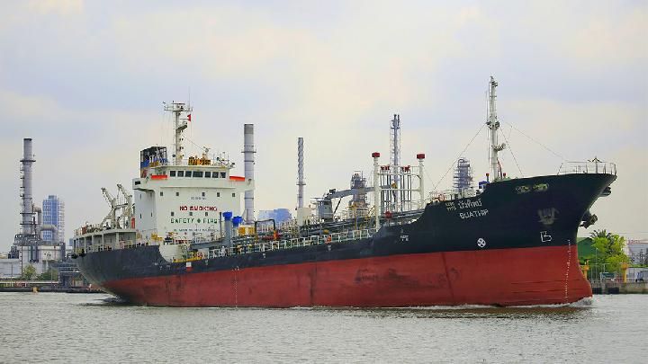
BMKG Warns of Up to 4-Meter Waves in Eastern Indonesian Waters
1 hari lalu
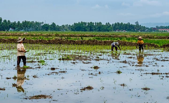
The potential of high waves in several regions could pose risks to maritime safety.
BMKG Warns of 6-Meter-High Waves in Southern East Nusa Tenggara
12 hari lalu
Tropical Cyclone Nokaen and Tropical Cyclone 97S trigger high waves and wind in Indonesian Waters.
BMKG: Beware of 6-Meter Extreme High Waves off Java Coasts
13 hari lalu

BMKG detects high waves triggered by the activities of Tropical Cyclones Nokaen and Tropical Cyclone 97S in the next three days.
BMKG Warns of 6-Meter Waves in Indonesian Waters Due to Cyclone Jenna
28 hari lalu
Cyclones Jenna and Seed 90W have triggered stronger winds and high waves.
BMKG Warns of High Waves in Indonesian Waters Due to Cyclone Jenna
28 hari lalu

The influence of tropical cyclone Jenna has resulted in the highest wind speed observed in the North Natuna Sea and the Indian Ocean west of Bengkulu to Lampung.
BMKG: No Increased Rainfall as Cyclone Seed 93S Moves Away from Indonesia
43 hari lalu

Indonesian weather is finally free from the influence of cyclone seed 93S. But the drifting storm is expected to strengthen as it moves away.
BMKG Details Impact of Cyclone Seed 91S on Sumatra Weather
55 hari lalu
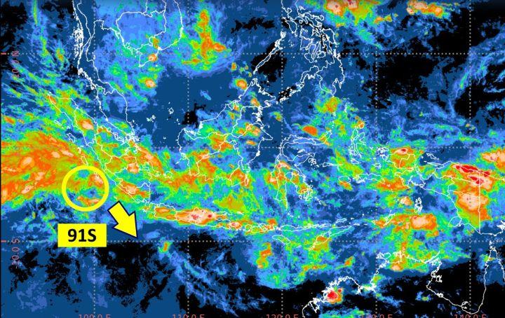
Head of BMKG Teuku Faisal Fathani urges the public to remain calm but vigilant.
Extreme Weather Brews as Two Tropical Cyclones Surround Indonesia
26 November 2025
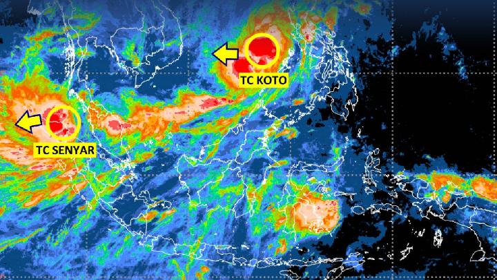
BMKG detected two tropical cyclones affecting the weather in Indonesia, namely Tropical Cyclone Koto and Tropical Cyclone Senyar.
Tropical Cyclone FINA Stirs Arafuru Sea, Triggers High Waves
20 November 2025
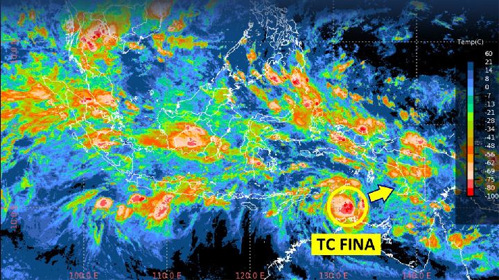
BMKG issues a warning about the high waves of 4 meters in several zones due to the wind effects of tropical cyclone Fina located in the Arafuru Sea.
BMKG Warns of 4-Meter High Waves in the Indian Ocean and North Natuna Sea
17 November 2025
Potential high waves in several areas could pose risks to maritime safety.