December 18, 2025 | 02:24 pm

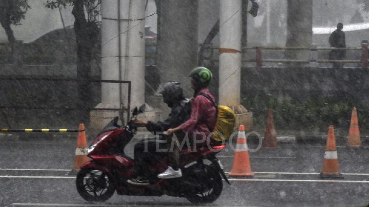
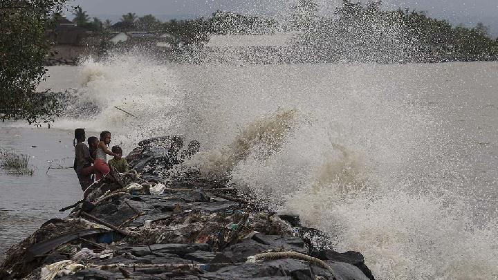
TEMPO.CO, Jakarta - The Meteorology, Climatology, and Geophysics Agency (BMKG) has issued an early warning of high wave potential in several water areas in Indonesia from December 18 to 21, 2025. The high waves, as well as strong winds, are influenced by Tropical Cyclone Bakung in the southwest Indian Ocean off Lampung, the 93S cyclone seeds in the south Indian Ocean off East Java, and the 95S cyclone seeds in the west of the Arafura Sea off South Papua.
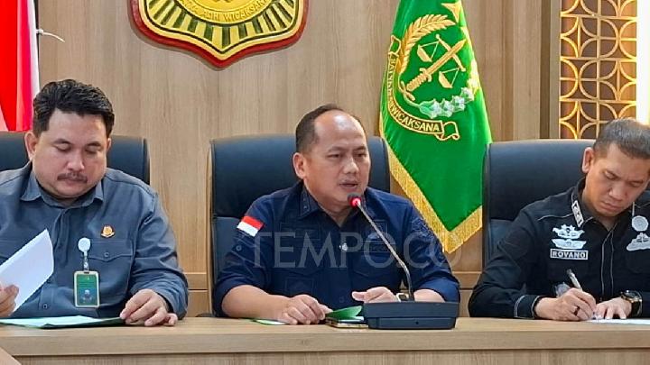
"The highest wind speeds were observed in the Karimata Strait, the western part of the Java Sea, the Sunda Strait, the South Indian Ocean off the coast of Java, and the Arafura Sea," said BMKG forecaster M. Soleh Ismail in a written statement on Thursday, December 18, 2025.
Soleh explained that the wind pattern in the northern part of Indonesia generally moves from the northwest to the northeast at speeds ranging from 8 to 30 knots, while in the southern part of Indonesia, it generally moves from the southwest to the northwest at speeds of 6-30 knots.
He added that this condition causes an increase in waves ranging from 1.25 to 2.50 meters that may occur in the western part of the Indian Ocean off Aceh, the Mentawai Islands, and Lampung. This phenomenon may also occur in the southern Indian Ocean, off the coasts of Banten, Bali, and NTT. The same high wave potential may occur in the southern part of the Karimata Strait, the central part of the Java Sea, the Sawu Sea, the Maluku Sea, the northern Pacific Ocean off West Papua, and the western and eastern parts of the Arafura Sea.
Waves of 2.5 to 4.0 meters are likely to occur in the southern Indian Ocean off the coasts of Central Java, East Java, and Yogyakarta. It may also occur outside of that area in the northern Pacific Ocean off Maluku. "The potential for high waves in several regions may pose a risk to maritime safety," Soleh said.
Impact of Cyclone Bakung and 2 Cyclone Seeds
Tropical Cyclone Bakung has grown from the tropical cyclone seeds 91S since December 12. As of yesterday, its position was around the southwest Indian Ocean off Lampung with a predicted decrease in strength soon.
Tropical Cyclone 93S began to form on December 11. Its current position is around the south Indian Ocean off East Java. This cyclone seed still has a moderate to high chance of becoming a tropical cyclone.
In addition to high waves, this cyclone will bring moderate to heavy rainfall to Central Java, DIY, East Java, Bali, West Nusa Tenggara, and East Nusa Tenggara. There are also strong winds along the southern coast of West Java and Bali.
Tropical Cyclone 95S began to form on December 15. Its current position is in the waters of the Arafura Sea off the southern Aru Islands in Maluku. Its chances are still low to become a tropical cyclone.
In addition to high waves, this cyclone will bring moderate to heavy rainfall to South Papua and heavy to very heavy rainfall to southern and southeastern Maluku. It will also bring strong winds to southeastern Maluku.
Read: Morning Rain Sweeps Across Greater Jakarta from the South
Click here to get the latest news updates from Tempo on Google News
Two Cyclone Seeds Trigger High Waves and Powerful Winds in the Nias Islands
21 hari lalu

BMKG reminds mariners of the effects of cyclone 95B and 92W winds. The latest high wave early warning is valid from 26-29 November 2025.
BMKG Issues Early Warning for High Waves in Waters North of Papua
34 hari lalu

BMKG records cyclone seeds in the northern waters of Papua, indirectly affecting the formation of high waves in several areas.
BMKG Issues High Wave Warning in Several Indonesian Waters
36 hari lalu

The Indonesian Meteorology, Climatology, and Geophysics Agency (BMKG) has issued an early warning of high waves in several Indonesian waters.
BMKG: Beware of 6-Meter High Waves in South Banten
27 Agustus 2025

The latest early warning from BMKG regarding high waves lasts until August 30, 2025. Strong winds are also detected in the waters off the west of Lampung.
Bali's Waterblow Tourist Site Temporarily Closed Due to High Waves
7 Agustus 2025

ITDC enhances security measures around Waterblow and Nusa Dua, focusing on the Peninsula Island and Nusa Dharma Island.
The Japanese Origins of the Word 'Tsunami'
1 Agustus 2025
The origin of the word "tsunami," which means "harbor wave" in Japanese, and its global usage.
BMKG Issues Early Warning of High Waves Caused by Cyclone 99S
20 Februari 2025
BMKG has issued an early warning of high waves that are potentially to occur in several maritime areas in Indonesia on February 20-23, 2025.
BMKG Advises Fishermen to Exercise Caution Due to High Waves, Particularly in Mentawai and Bali Strait
29 September 2024

Indonesia's Meteorology, Climatology, and Geophysical Agency (BMKG) issues an early warning regarding the sea's high waves up to a height of 2.5 m.
BMKG Warns of 4-meter High Waves in Indonesian Waters Today
28 Februari 2024

BMKG issued an early warning for high waves today in several Indonesian water areas, including in the Banda Sea.